The Plat to Scale
The whole community drawn to scale: the inner square of residential villages, numbered 1 to 96, with the stadium and the two public blocks at its centre; and beyond the easements, the 96 mirrored villages carrying agriculture, animals, industry, and rental and logistics, each answering to the residential village whose number it bears. A hub stands at every intersection.
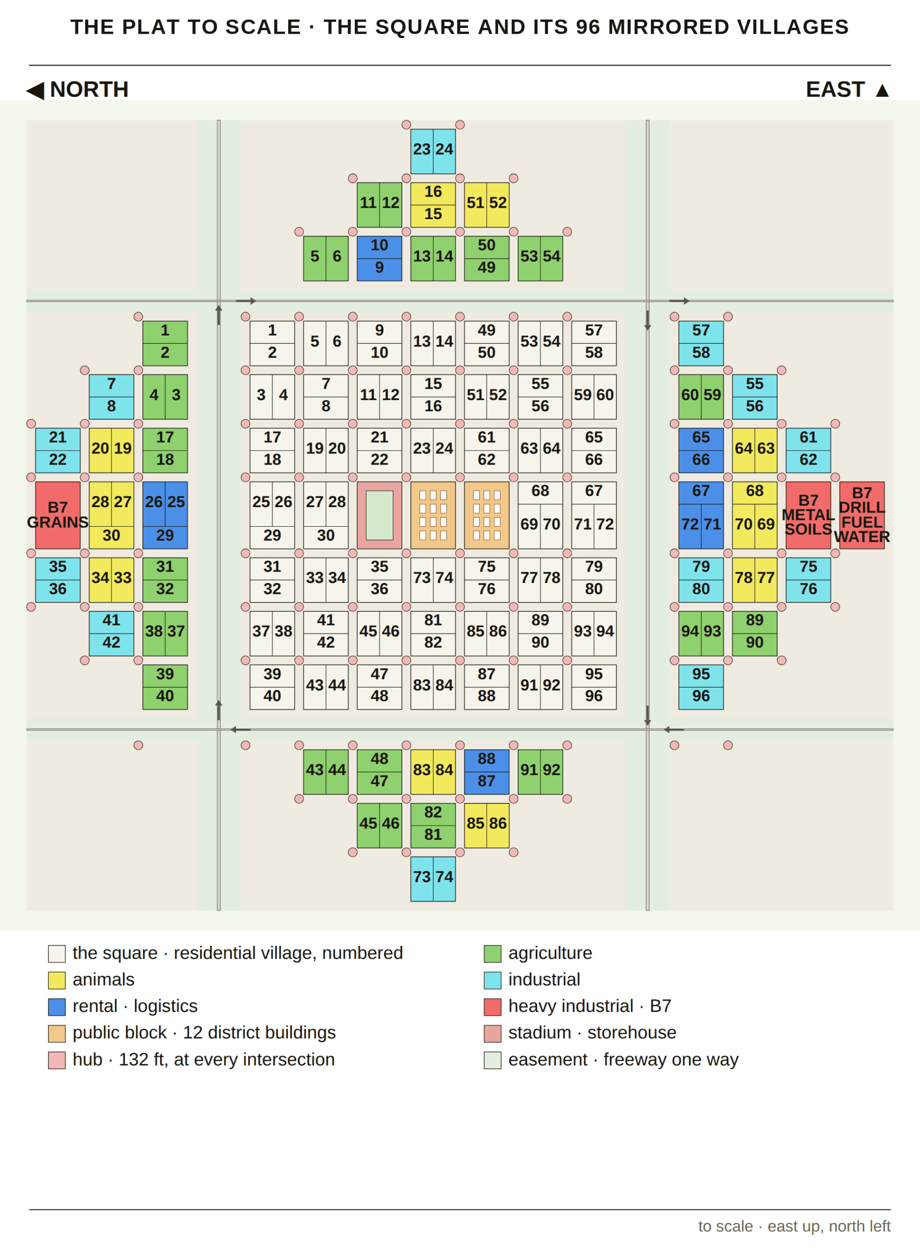
This is the one drawing of the whole community, redrawn from the 1833 plat at a single scale. The 96 residential villages fill the inner square; each mirrored village beyond the easements carries the same number and answers to that village’s council. Reading across from any village to its mirror shows where its farms, animals, workshops or rental fleet stand. The plat itself, and how its measures close, is explained on The Plat of the City of Zion, 1833.